Mohamad Alif Fikri bin Mukhtar
From field datato product.
Eight years building AI, IoT, GIS and computer-vision platforms across five industries, from a drone-data SaaS built by 64 engineers to smart-city systems run by local authorities.
Alif MukhtarProduct and technology lead · Malaysia
Introduction MeetupOctober 2026
Presenting to
I turn engineering problems into products people deploy.
Product and project leader with 8+ years across AI, IoT, GIS and computer vision. I write the requirements, lead the engineers and stay with the product until it is running on site.
- 2023 – nowCo-founder & CEO, AI start-up · AI & Earth Observation
- 2023 – nowProject Manager, BWTMS · smart-city, maritime and oil & gas platforms
- 2023Operation Consultant, Inttech Technologies · IoT and learning platforms
- 2022 – 2023Product Manager, Aerodyne Group · DRONOS drone-data SaaS
- 2020 – 2023Product Design Manager, then CPO, Synapse Innovation
- 2015 – 2016System Engineer, Mesiniaga Berhad
MSc IT Entrepreneurship, UTMBCS Software Engineering, UMISTQB CTFL
64 engineersled on one platform
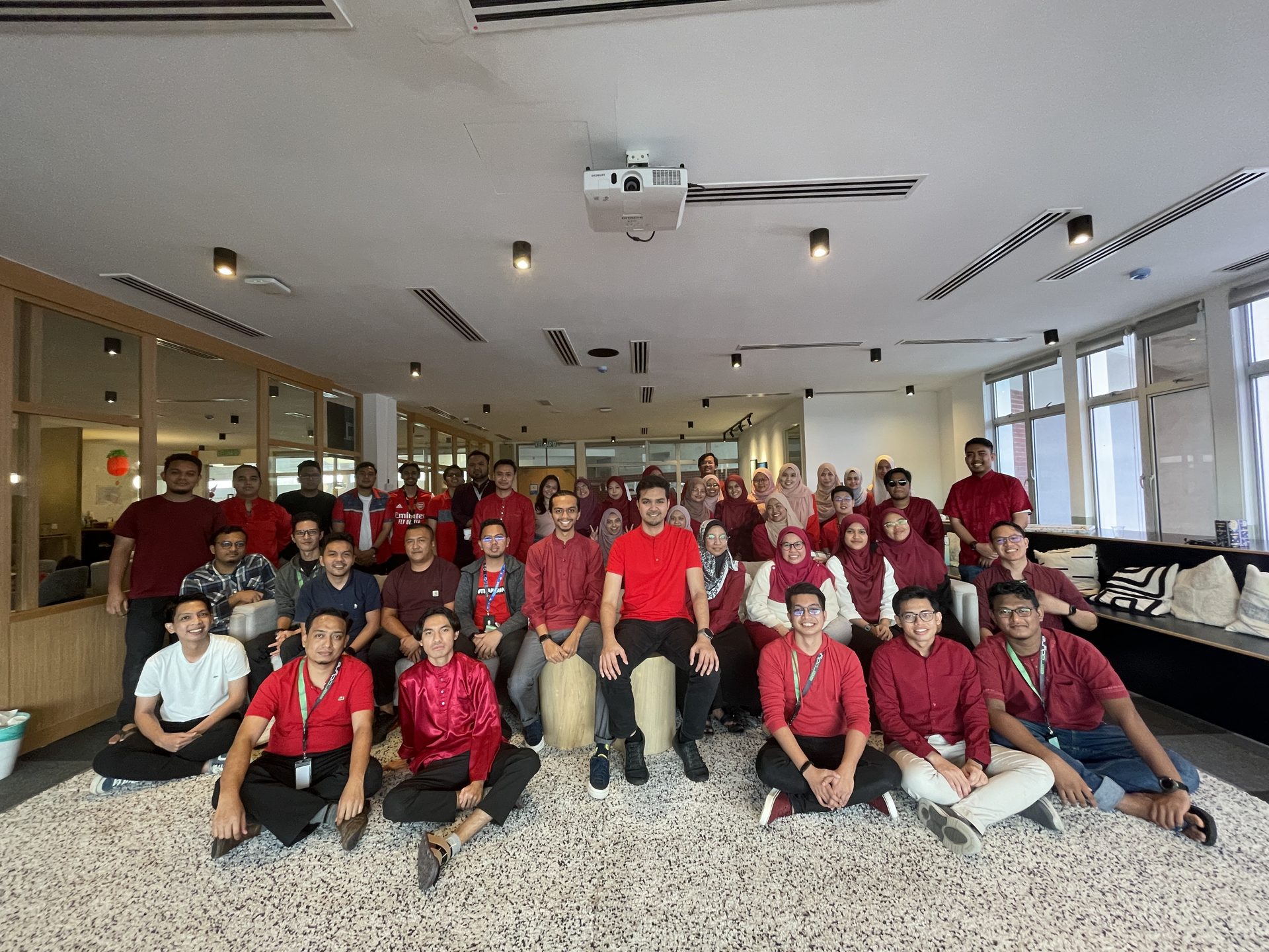
5 industriesone way of working
Product Manager · Aerodyne Group · 2022–2023
Droneindustry.
A drone-agnostic platform that takes raw flight data to an inspected, reported asset.
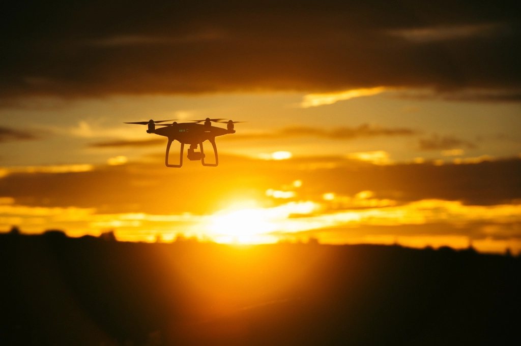
Drone data intelligence platform
One platform for any drone, any asset.
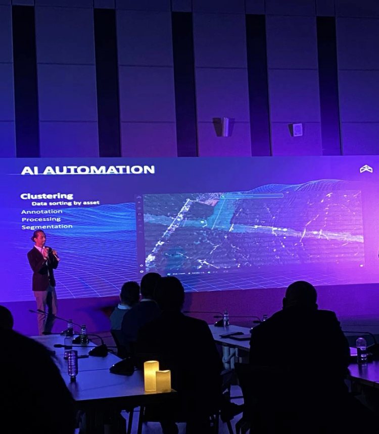
DRONOS is a drone-agnostic automation SaaS: it takes raw flight data to an inspected, reported asset on a 3D map. I directed product strategy and delivery for the whole platform.
RM2Mplatform programme
64engineers: AI, software, UI/UX
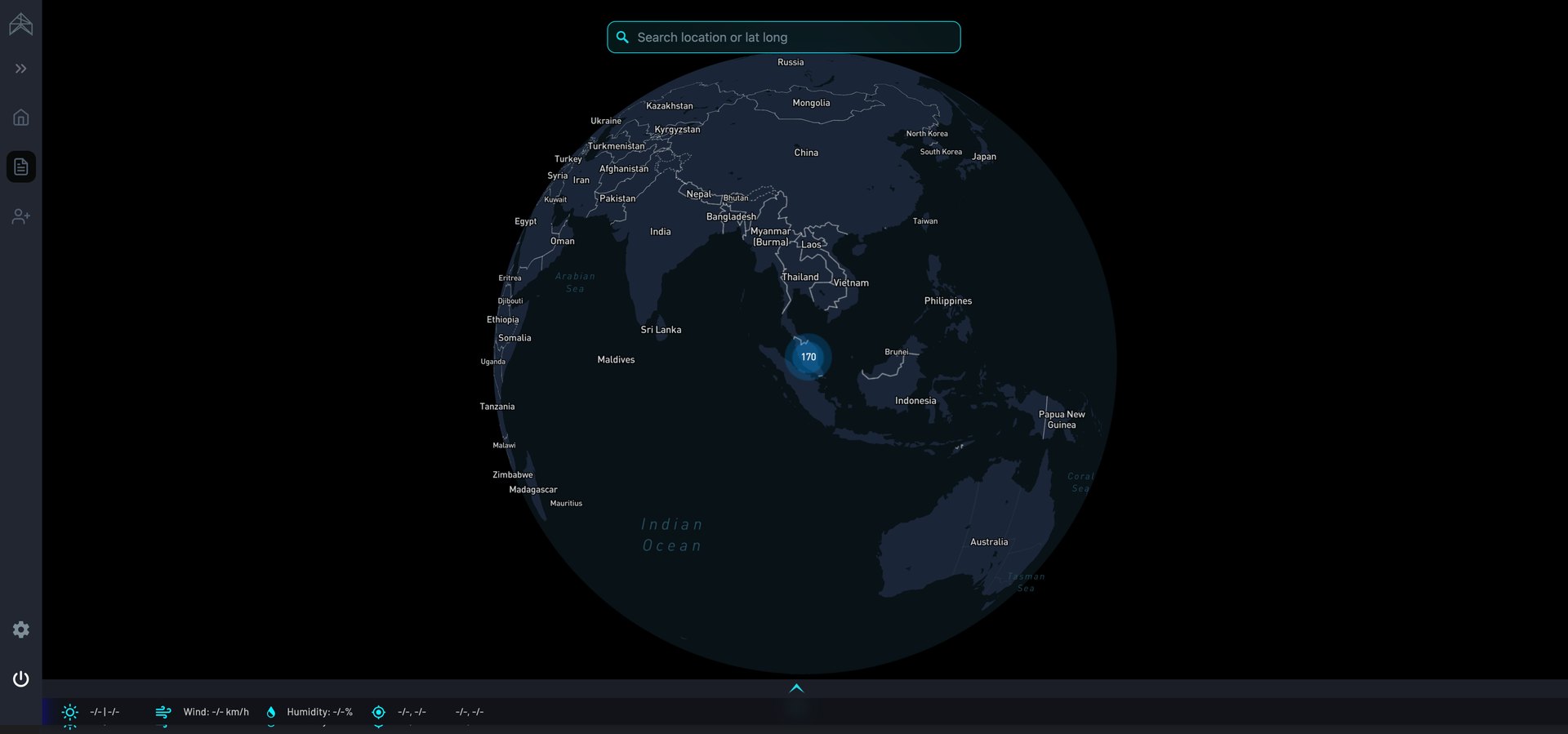
- Uploadcloud ingest, smart clustering
- Process2D, 3D and thermal
- AnalyseAI annotation, segmentation
- Validateengineer confirms defects
- Reportgenerated per asset
Renewables
Solar and wind: find the fault across the whole site.
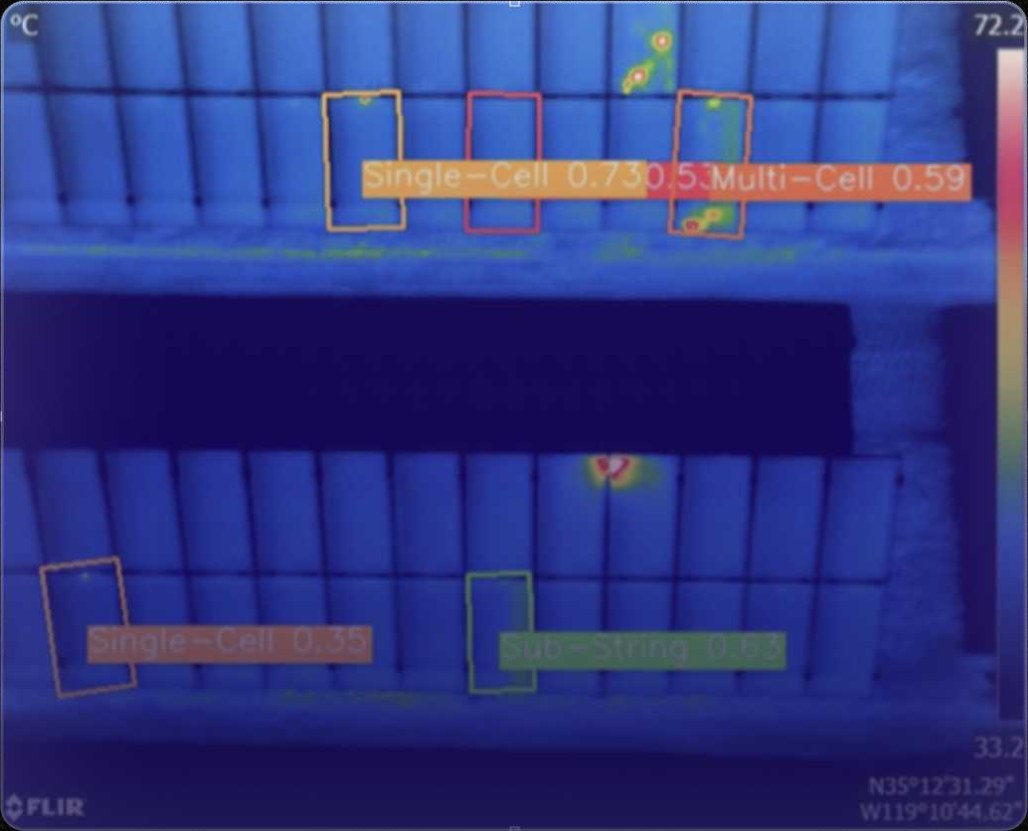
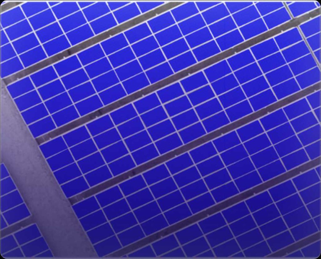
Solar farmsThermal images from the drone are processed so a hot cell or string stands out across thousands of panels. Panels are segmented, and each fault is classed and pinned to its place on the site map.
Wind turbinesThe same capture-to-report pipeline, applied to blade inspection: images grouped by turbine and blade, defects annotated and reported per asset.
Safety and site monitoring: the drone as a second pair of eyes.
Object-detection models read the same footage a safety officer would, and flag what needs a person to look.
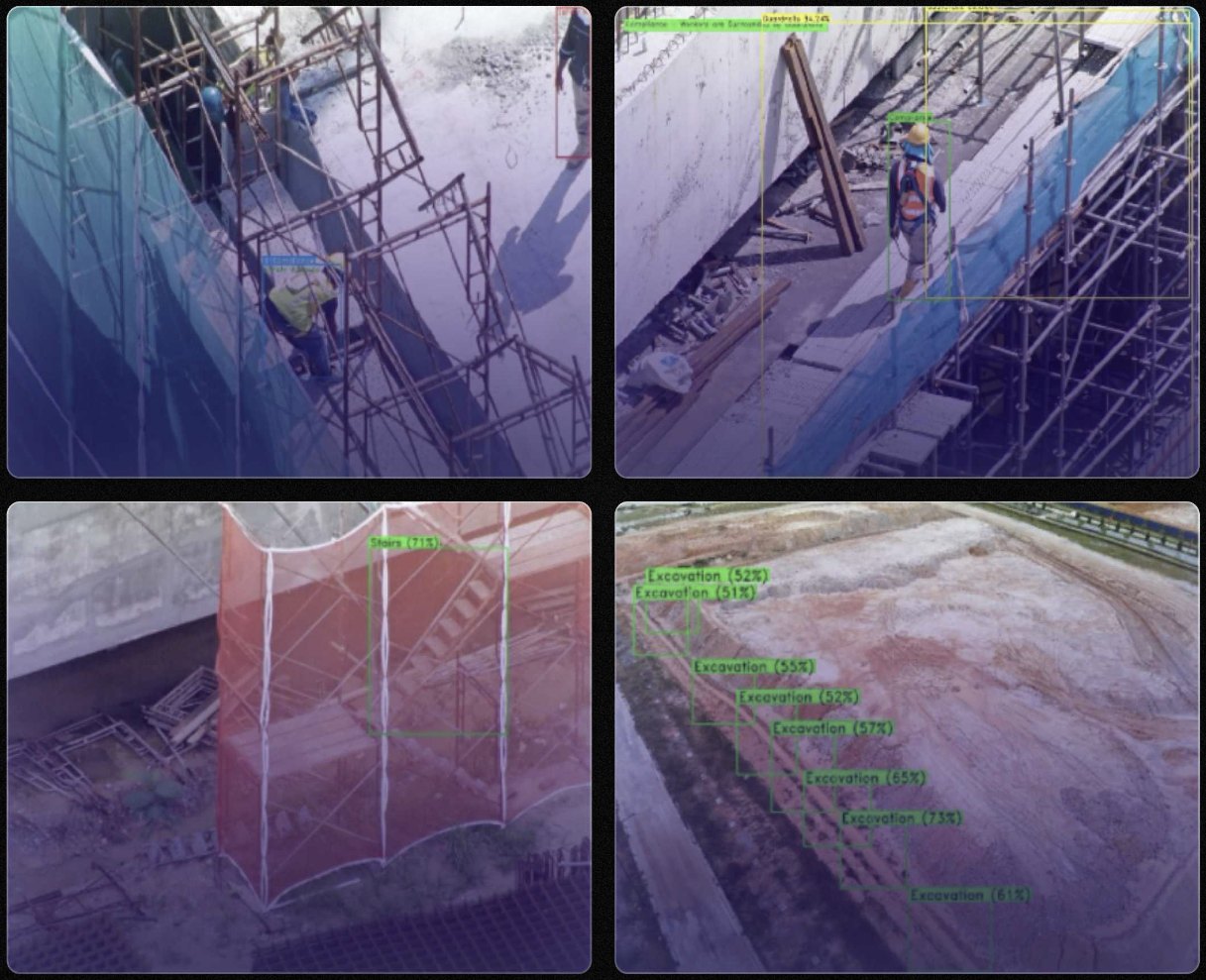
Safety compliance
Is the site working safely?
Detects PPE (helmet, boots, vest), safety harnesses, guardrails, stairs with handrails and barricaded excavations.
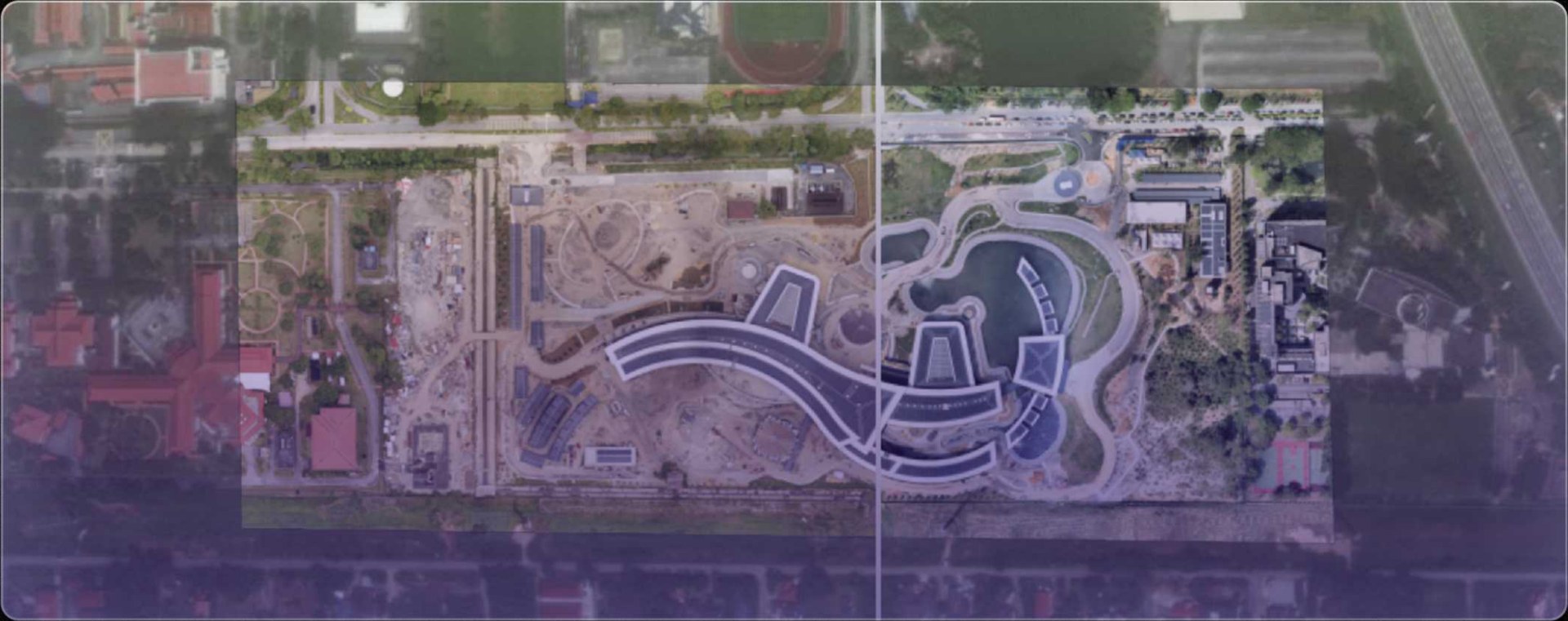
Construction monitoring
What changed on site?
Co-founder & CEO · 2023–present
Healthcareindustry.
AI that reads the image a clinician is already looking at: an ECG, a mammogram, a retina.
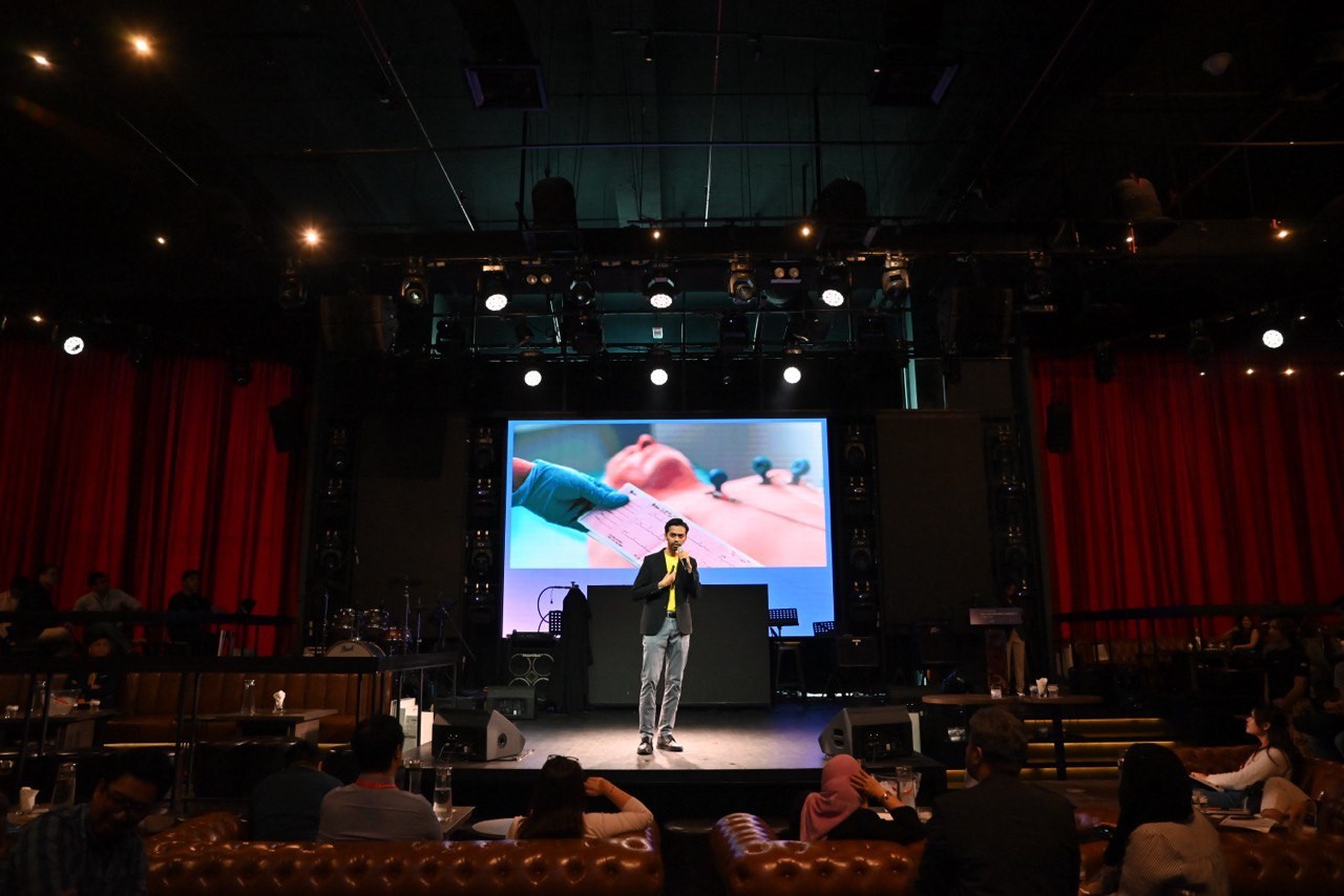
AI-powered ECG interpretation
A second read on every ECG, from a phone photo.
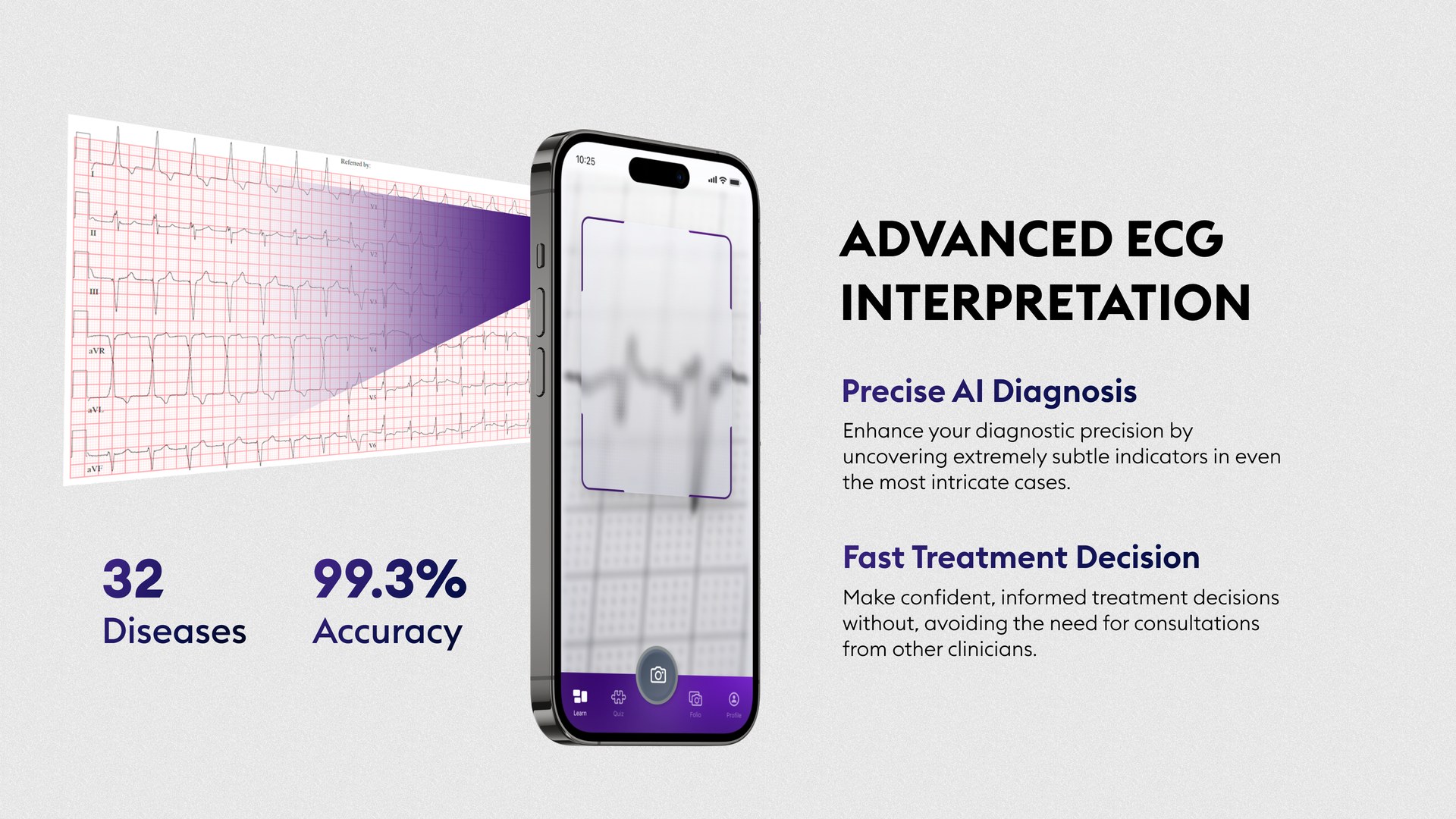
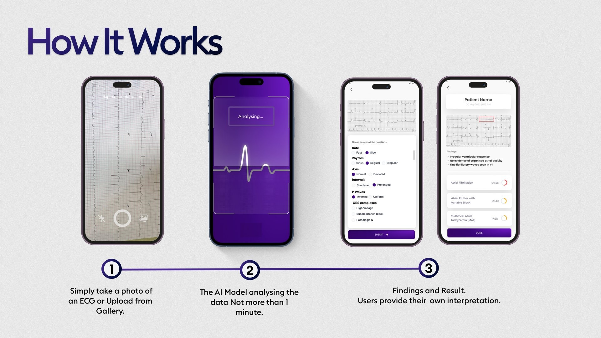
A clinician photographs a paper ECG. The app digitises the trace, classifies abnormalities and returns findings with confidence scores in about a minute.
88,238labelled ECG records, from 8 PhysioNet sources
98.1%accuracy reported after fine-tuning, Dec 2024
26pilot users: doctors, nurses, medical students
RM100KCradle CIP Spark grant
MyStartup Pre-Accelerator finalistDecision support for practitioners
AI-driven cancer detection
Cancer screening support, one image at a time.
A research collaboration with Universiti Kebangsaan Malaysia. The clinician uploads a scan and gets a likelihood score, with the suspicious region highlighted.
 Research partnerR&D collaboration
Breast · MammoSenseFour mammography views in, a score per side outBI-RADS category, bounding boxes and Grad-CAM heatmaps.
Lung · in developmentNodule detection on CT and X-ray
Eye · RetinaSenseA retinal photo classified across 8 conditions
Eye-screening platform, built with Airis DX
Mass eye screening, triaged by AI before the specialist.
Optom DX runs community eye-screening events from registration to referral. My team supplies the AI that reads each fundus image and flags who needs to be seen.
- QR registration and screening-event management
- Six-step digital assessment, from history to refraction
- AI fundus classification across 8 classes, in under 5 seconds
- Referral chain: operator, optometrist, specialist
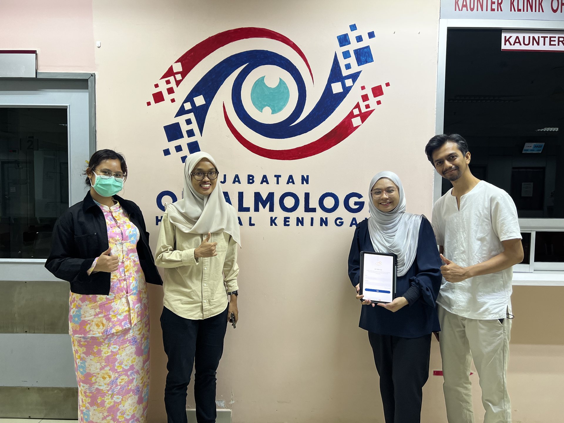
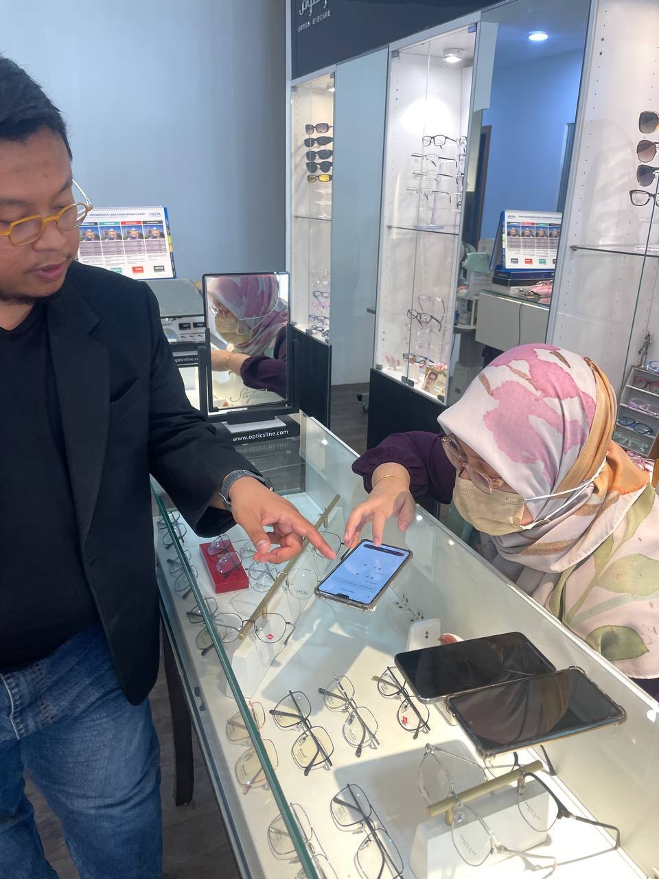
PilotedOphthalmology Department, Hospital KeningauPilot and user acceptance testing completed.
Project Manager · BWTMS · 2023–present
Oil & gasindustry.
Condition monitoring for rotating equipment, and inspection reporting without the paperwork.
Two products for the plant floor.
One listens to rotating equipment. The other replaces the Word document that every inspection ends in.
Plants and marine
BW-Pulse
Predictive maintenance and condition monitoring.
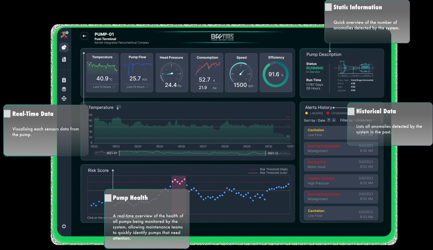
- Vibration, temperature, flow, pressure, current
- Risk and health scores for every asset
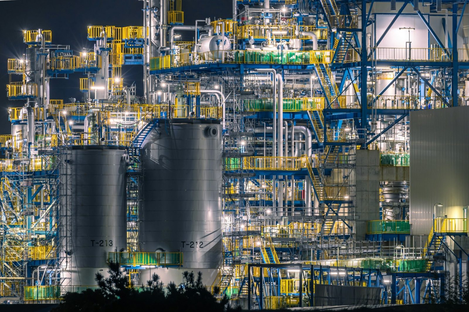
- In production at a petrochemical complex
Inspection and NDT
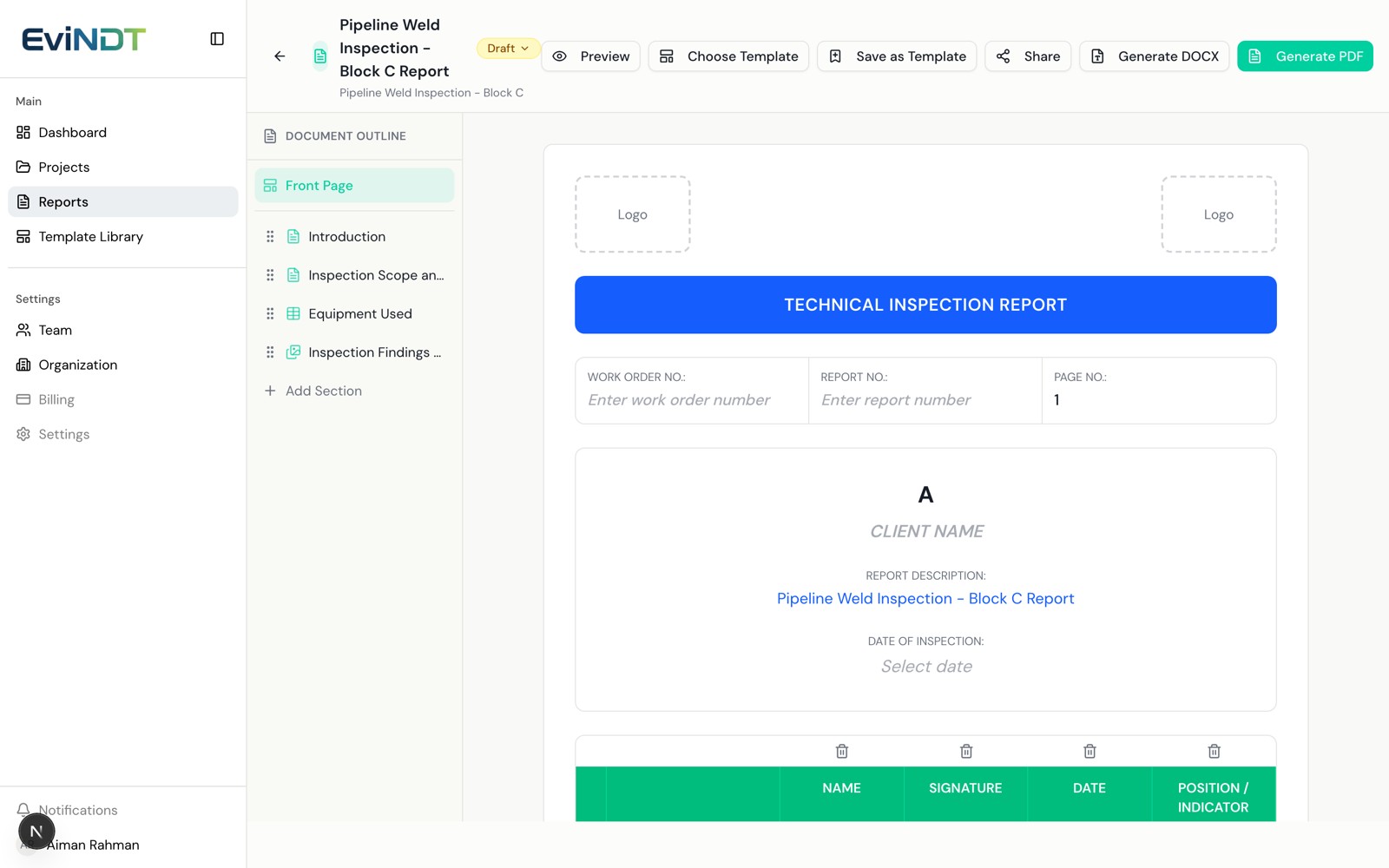
EviNDT
Inspection reports built in the browser.
- Template-based report builder
- Photo annotation without leaving the report
- Branded PDF and DOCX in one click
Also deliveredE-LogI asset integrity management, onshore and offshoreBCTRACK vessel monitoring, 300+ vesselsFeature detection for seismic survey, 10 object classes
Predictive maintenance and condition monitoring
Hear the failure before it happens.
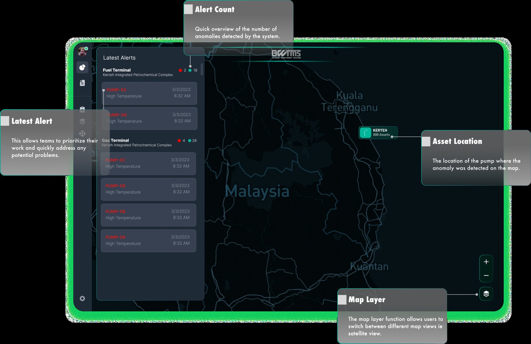
Maintenance planned on running hours gives no warning of the bearing, alignment or cooling fault that develops between inspections. BW-Pulse watches the asset continuously and raises the alert while there is still time to plan.
TemperatureVibrationCurrentFlow
PressureSpeedEfficiencyAlerts
In productionKerteh Integrated Petrochemical ComplexCentrifugal pumps, Terengganu
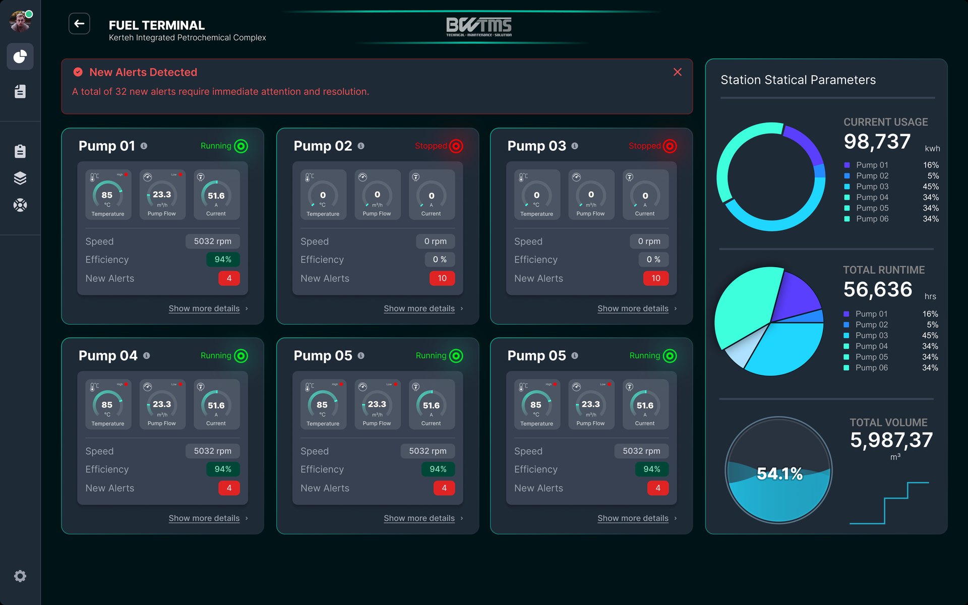
Site, station, asset: three levels, one click apart.
Sensor to screenSensor, edge gateway, MQTT, dashboardReadings every 60 seconds; 30 days buffered at the edge if the link drops.
NextMarine diesel enginesA 12-month pilot proposed for a harbour tug.
Reporting for NDT and inspection engineers
The inspection report, without Microsoft Word.
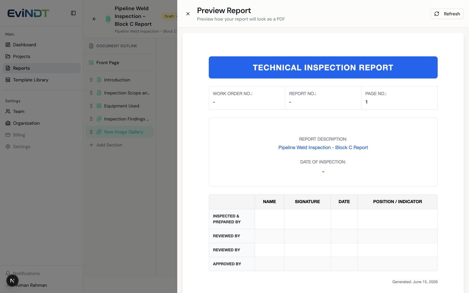
Engineers build, annotate and export the report in the browser. The template carries the structure, so the engineer only adds the findings.
- Six section types: text, checklist, table, photo gallery, signature, divider
- Photo annotation, crop and enhance, without altering the original
- Branded PDF and DOCX export, plus read-only share links
Liveevindt.comBuilt for Beyond Horizon.
From brief to live SaaS in eight months.
A multi-tenant product: every inspection company that signs up gets its own workspace, branding and team.
Report builderTemplates and typed sections, edited with a live outline.
Evidence handlingImage galleries with annotation; originals kept intact.
Document engineServer-side PDF and DOCX in the client's branding.
Teams and rolesWho can edit, review and share, set per organisation.
Tenant isolationEach customer's data kept apart from every other's.
Admin control planeSubscription tiers and tenant management.
8 mokick-off to completion, Nov 2025 to Jun 2026
Laravel 12 and Next.js 16 on PostgreSQL and Redis
Project Manager · BWTMS · 2023–present
Smartcity.
Platforms that local authorities and government agencies run their daily operations on.
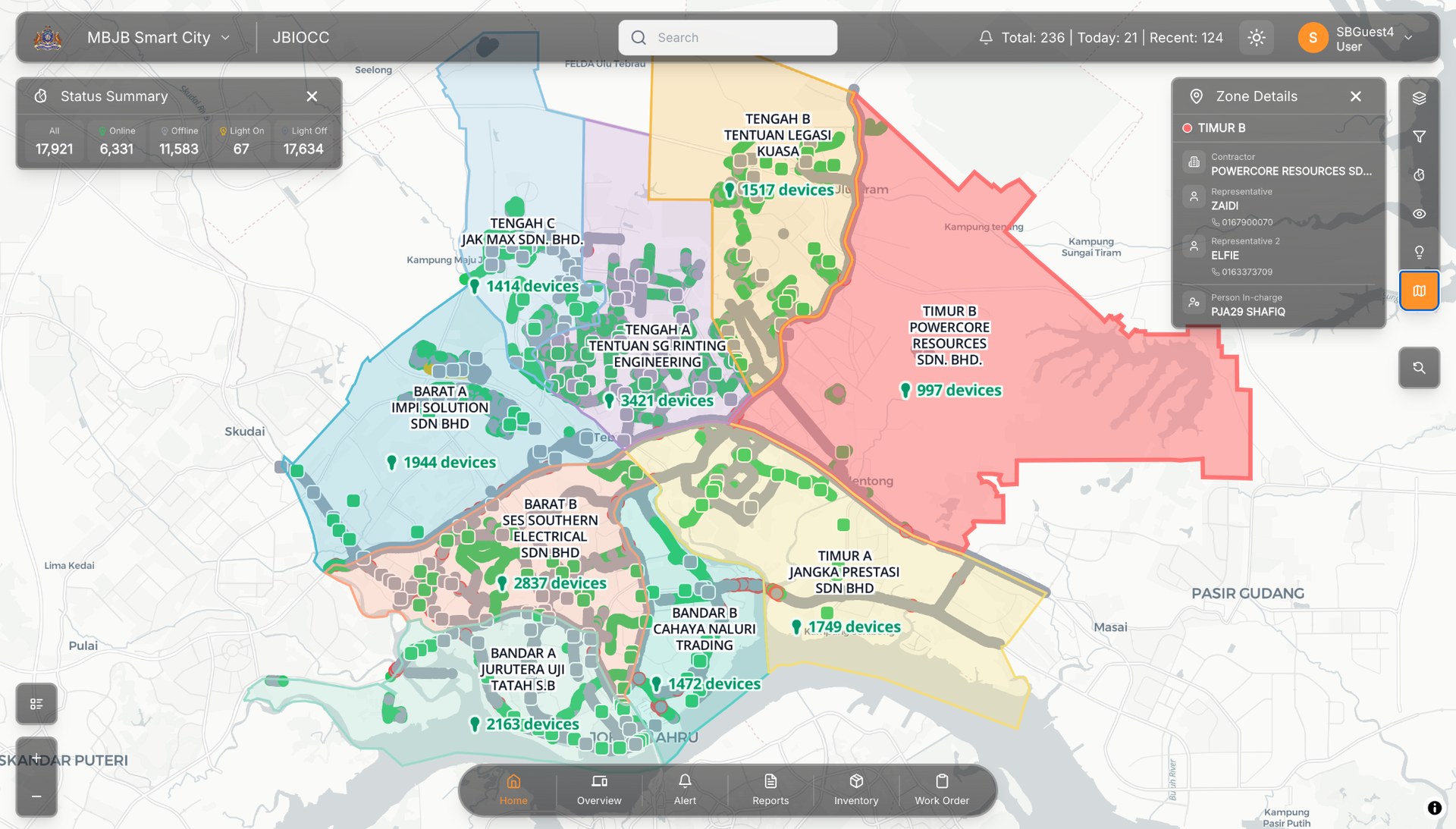
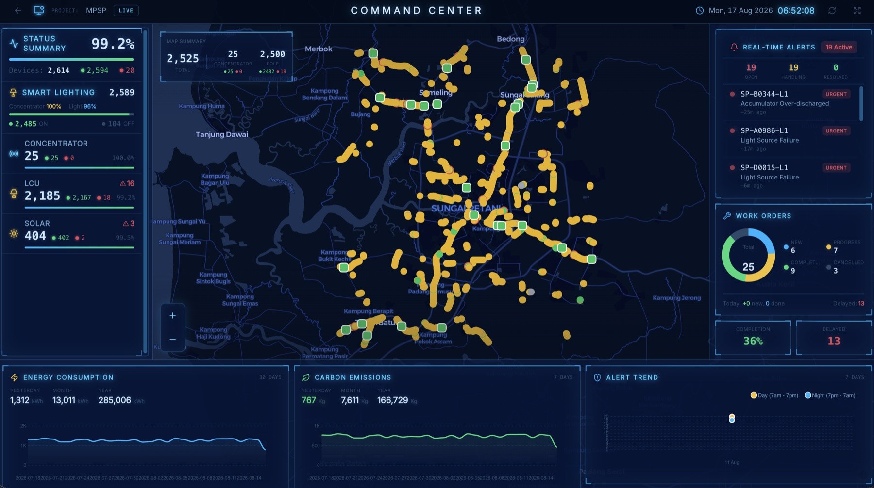
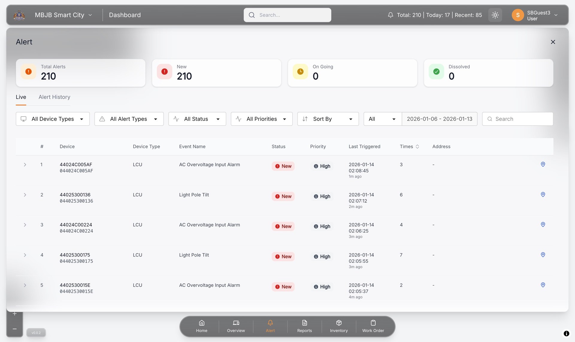
Every streetlight in the city, on one live map.
Local authorities monitor, control and maintain smart street lighting from one platform. A fault raises its own work order, and the repair is closed with photo evidence.
17,519units monitored for Johor Bahru
3deployments: MBJB, MPS, TNBES
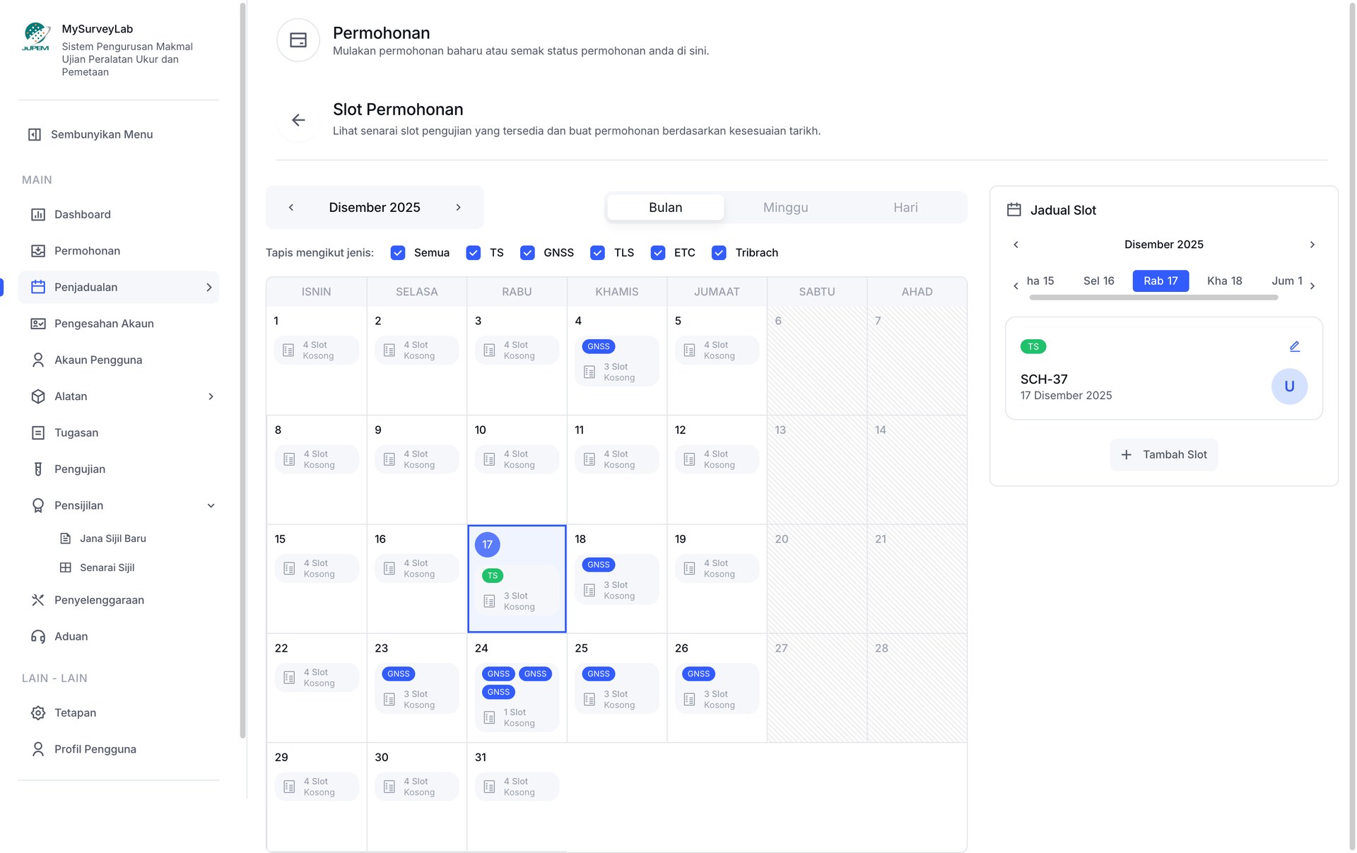
Survey and mapping equipment testing laboratory
A national survey-equipment lab, run end to end online.
MyPilar manages the testing laboratory of the Department of Survey and Mapping Malaysia: application, slot booking, testing, approval and the certificate, in one system.
- Apply and book a slot
- Register the equipment
- Test and record the data
- Approve and issue the certificate
15test types
9modules
7user roles
Total stationLaser scannerGNSSUAS cameraTribrach

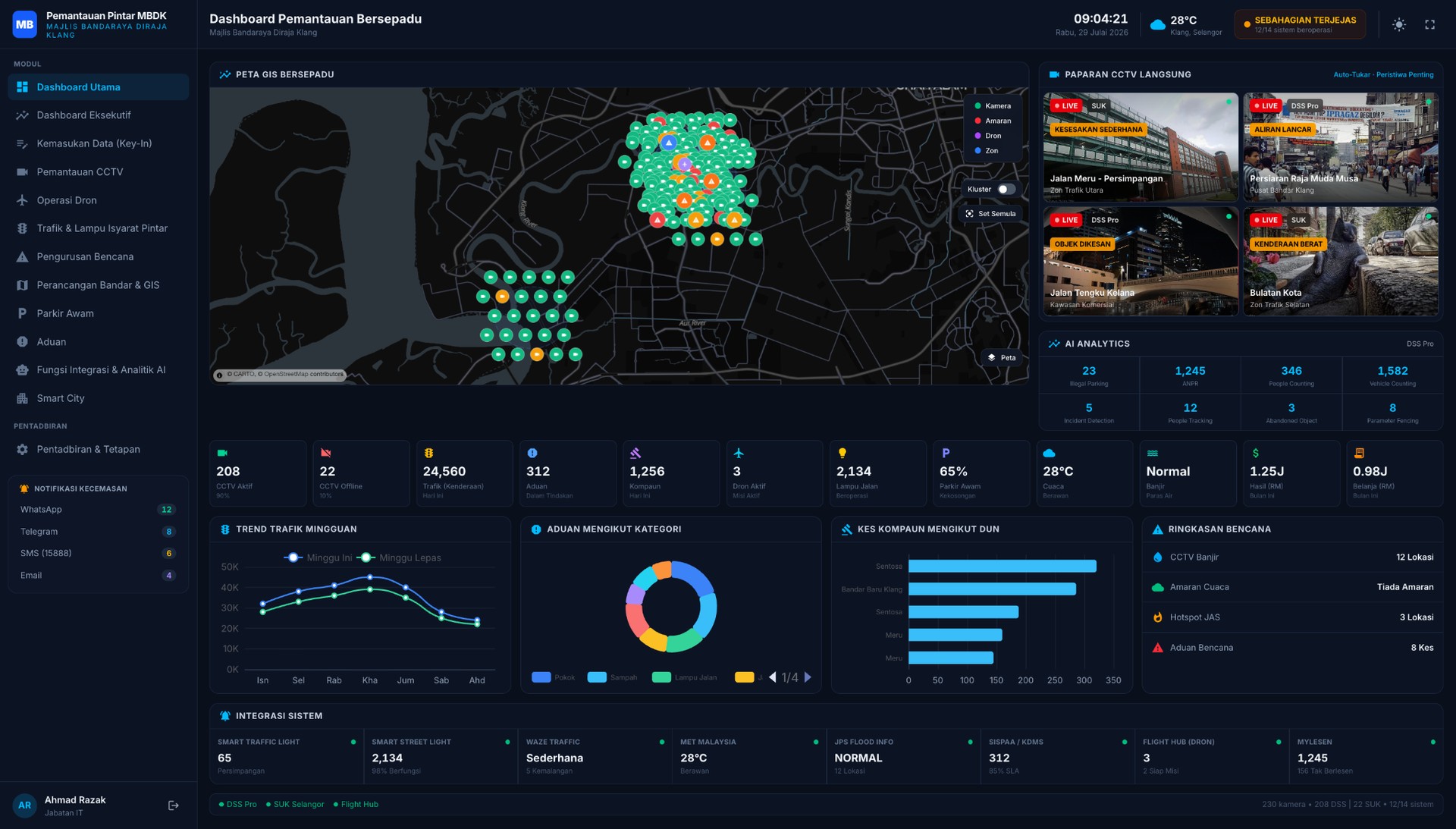
Majlis Bandaraya Diraja Klang
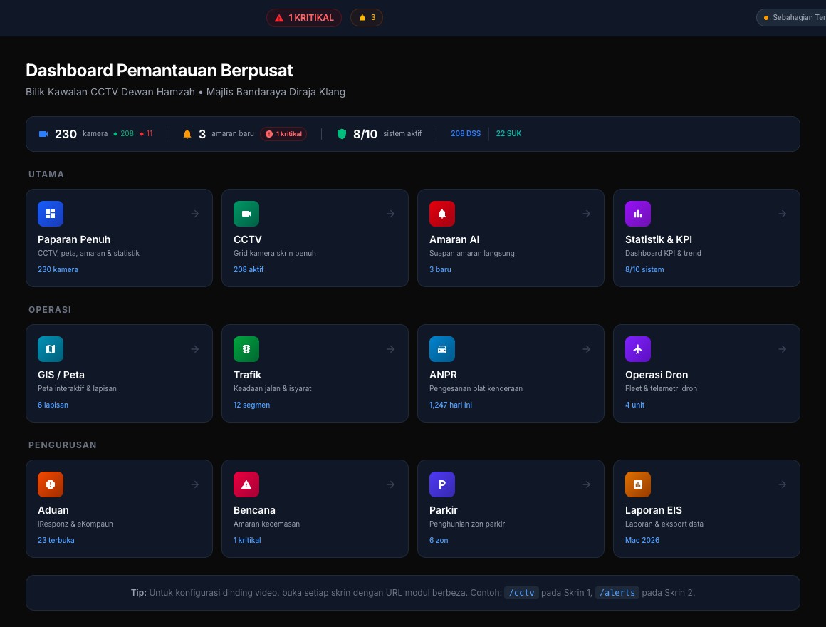
One wall for the whole city: CCTV, drones, traffic and GIS.
A cloud command-centre platform for Klang's city council, bringing its existing systems behind one AI-assisted monitoring dashboard for the control room.
11council systems integrated
61video-wall panels
6operator stations
CCTV and AI alertsTraffic and ANPRGISDisasterExecutive KPIs
Co-founder & CEO · 2023–present
Spaceindustry.
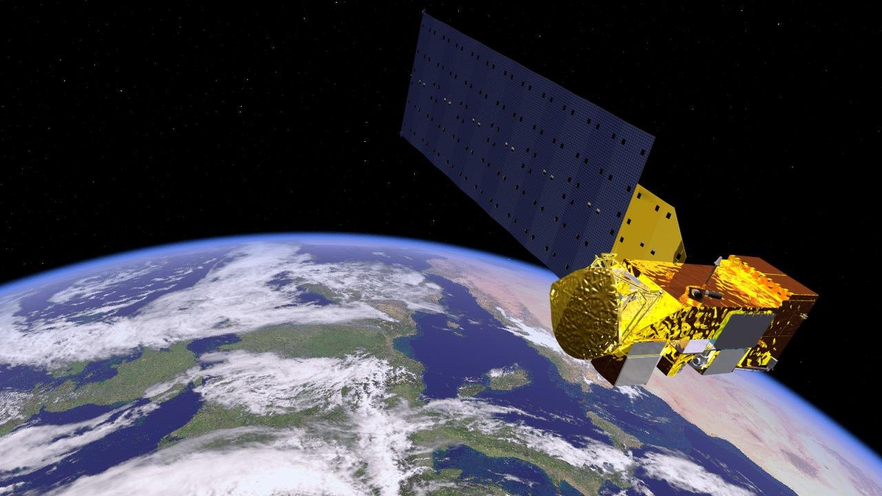
Satellite imagery turned into maps, compliance evidence and planning decisions.
Land-use and land-cover mapping
From a satellite image to a map a planner can use.
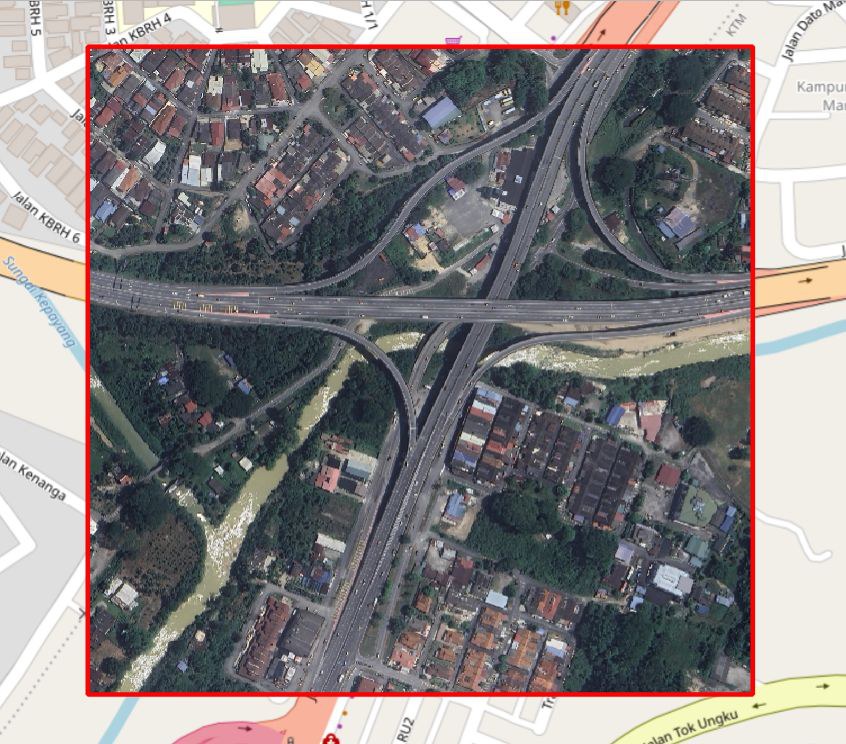
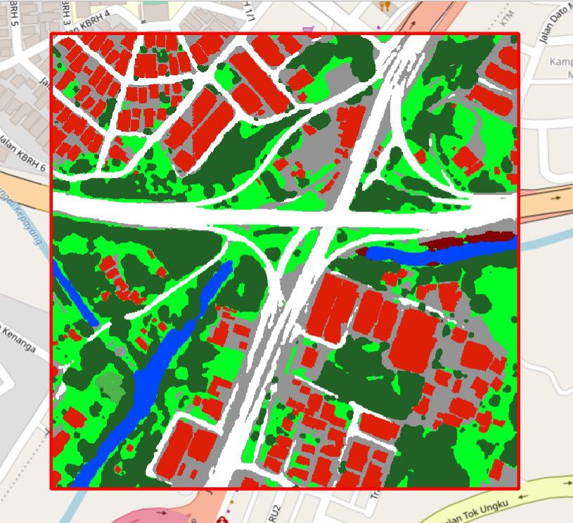
Our land-cover model classifies high-resolution imagery into eight classes and exports GIS-ready polygons with their areas.
8land-cover classes
0.6 mper pixel imagery
512 km²labelled training data
67–92%F1 by class, internal results
BuildingRoadPavementTreeGrassAgricultureWaterBare land
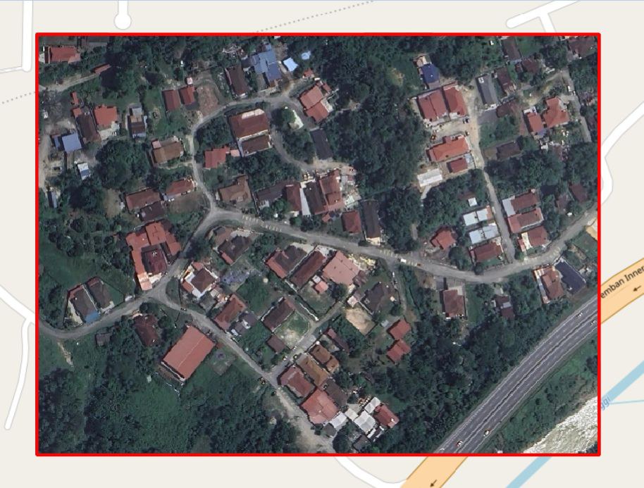
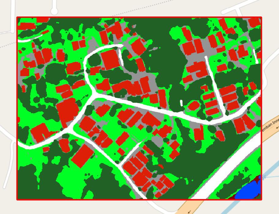
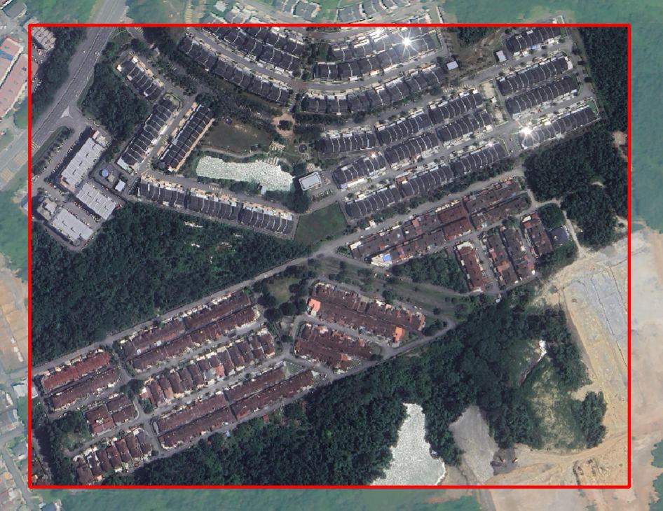
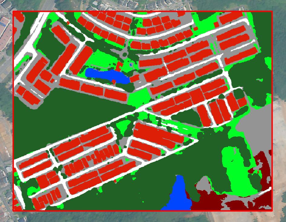
Geospatial AI for town planners
Digitize. Discover. Decide.
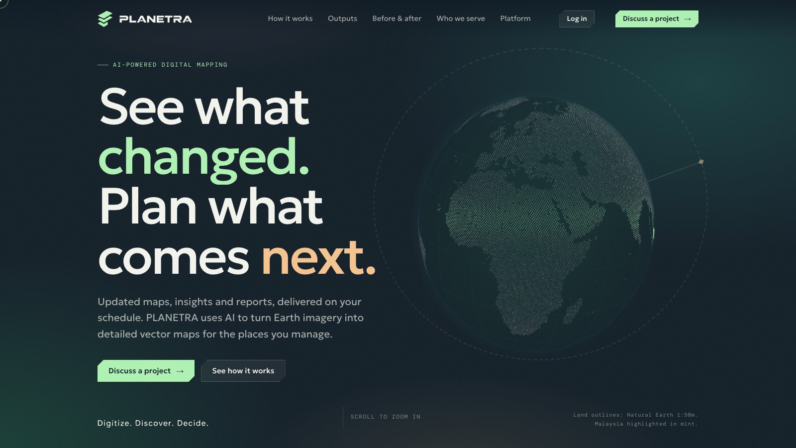
Planetra turns Earth imagery into detailed vector maps of the places a planner manages. It packages the land-cover model into a product a council officer or planning consultant can use alone.
Esri, Google, Sentinel-2 and Landsat imageryScheduled re-runsPDF report and GIS bundleEnglish and Bahasa Malaysia
LiveIn productionLand-cover analysis, imagery acquisition and reports in production.
- Draw the siteor upload a boundary
- Acquire imageryfrom several providers
- Classify land covereight classes, as polygons
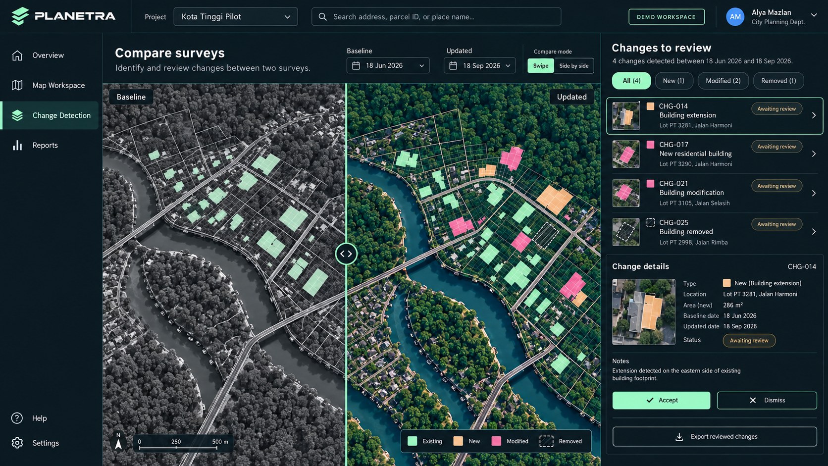
- Compareagainst cadastre, or an earlier date
- ReportPDF and GIS layers
Two dates, one answer
On a real site, the change is measurable.
Run the same site on two image dates and Planetra reports what was built, cleared or filled in between, as areas and counts a planner can act on.
2 → 109buildings detected between two image dates, Ainsdale, Seremban
−52.18 haof water at Gurney Wharf, Penang, 2015 to 2025
2,995polygons mapped in the Ainsdale pilot
What comes next
Theproposal.
The team I propose to build, and how we start.